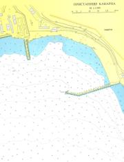
port map 1
800 x 1039 px
size 118 Kbytes
port map 2
1476 x 1917 px
size 252 Kbytes
|
GPS position of main breakwater: N 43° 24. 65 E 28° 21.4'
Dangers in approach : Fixed fish traps and nets.
VHF channels : None
Shelter : Good
Formalities : None
Charges:None
| Electricity | none |
|---|
| Water | none |
|---|
| Fuel | none |
|---|
| Repairs | none |
|---|
|